Alberta Creates App for Evacuated Fort McMurray Residents
Posted on Monday, May 16, 2016, 12:02 PM, by Cassandra Rose, under
Canada News
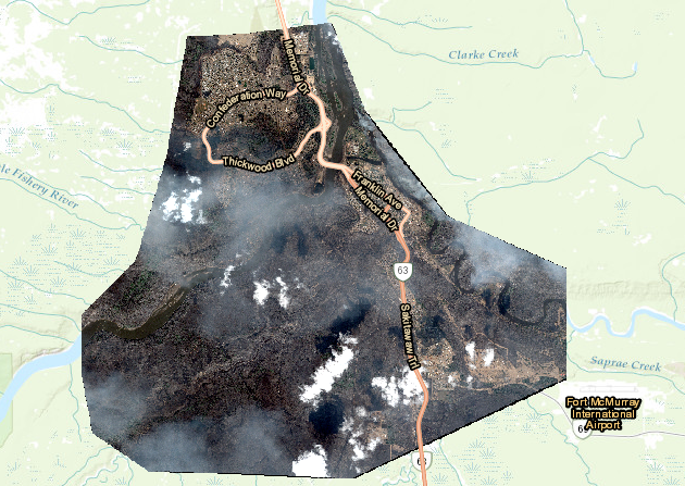
The Canadian government has released an app that allows evacuated Fort McMurray residents to see satellite images of their homes following the
destructive wildfire that began two weeks ago.
"These images will help us begin to answer the questions you have about the state of your homes and community," revealed municipal affairs minister Danielle Larivee in a
statement.
"These images should not be used for official damage assessments, determining the status of individual structures, or planning re-entry to the city."
Residents are being warned that these images may be traumatic.
The wildfire -- which damaged more than 2,400 structures and still covers around 2,410 square kilometres -- is expected to continue burning for another few weeks.
Where to download
You can
download the app on the Alberta government website.
8eb32b77-2ab8-4524-afa3-44d41698eb70|0|.0|43d7d415-1ae5-4d2c-9818-43ef12e66ebc
Tags : alberta, canada